How to Bike from Raleigh to Durham Using the East Coast Greenway
Tuesday, July 12, 2022, 9am by visitRaleigh
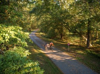
It's now possible to bike from Raleigh to Durham exclusively using greenways thanks to a few recently completed sections of trail in the Cary area. The 45-mile ride is a rewarding challenge and an incredible way to explore on two wheels!
The Raleigh area's cycling infrastructure is certainly on the rise.
In recent years, new bike lanes have been added to major thoroughfares in downtown Raleigh, a bike share program using electric bikes and docking stations officially launched, the city's first cycletrack was finished in 2020 and greenway systems in Wake County have continued to be expanded—nearly 200 miles of paved greenways meander through Raleigh and Cary alone.
And while the Neuse River Greenway Trail, running 30 miles north to south along the eastern edge of the city, likely remains the area's most popular greenway for outdoor recreation, a series of recently completed greenway sections in the Cary area have opened up new connections that allow for bigger adventures—it's now easy to ride a bike from downtown Raleigh to downtown Durham exclusively using greenways.
This 45-mile ride—passing though parks, art museums, college and university campuses and more—is part of the East Coast Greenway, an in-development route of trails and greenways that will ultimately stretch 3,000 miles up and down the East Coast. The route between Raleigh and Durham is currently the longest complete metro area stretch of the East Coast Greenway, and it's the perfect activity for building a day trip or overnight visit around.
Above you can see the full route. Below, you'll find this ride broken into five sections, with helpful notes about each section including mileage and notable sights. At 45 miles long and including more than 2,200 feet of elevation gain, this route is not exactly for beginners, but not an expert-only ride, either.
Feel free to pick and choose your start and end points to build a route that suits your needs on a given day. If you plan to tackle an extended section of this ride, it's highly recommended to keep the full route directions on hand to help navigate the connections of each trail section.


Downtown Raleigh/Dix Park to the North Carolina Museum of Art
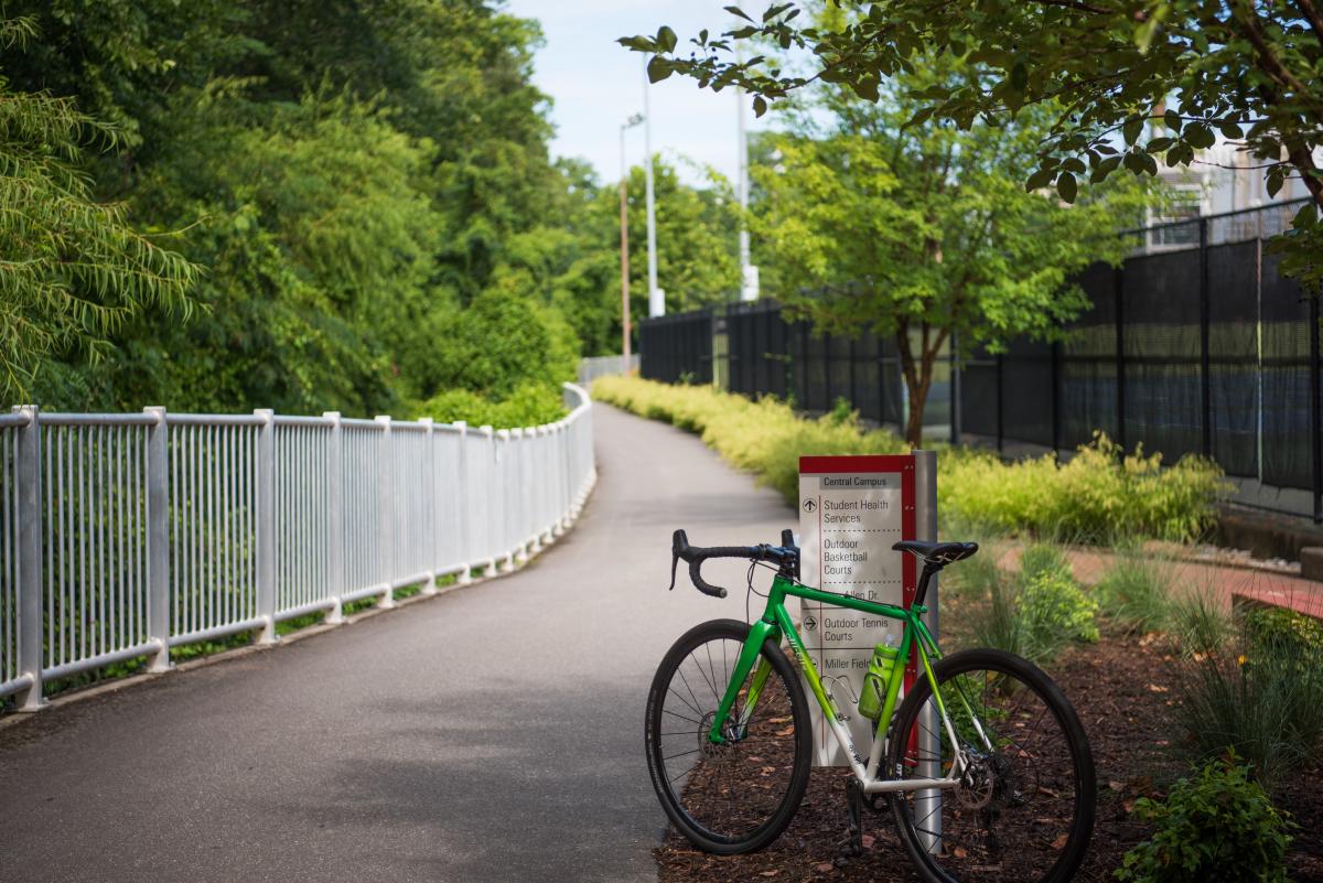
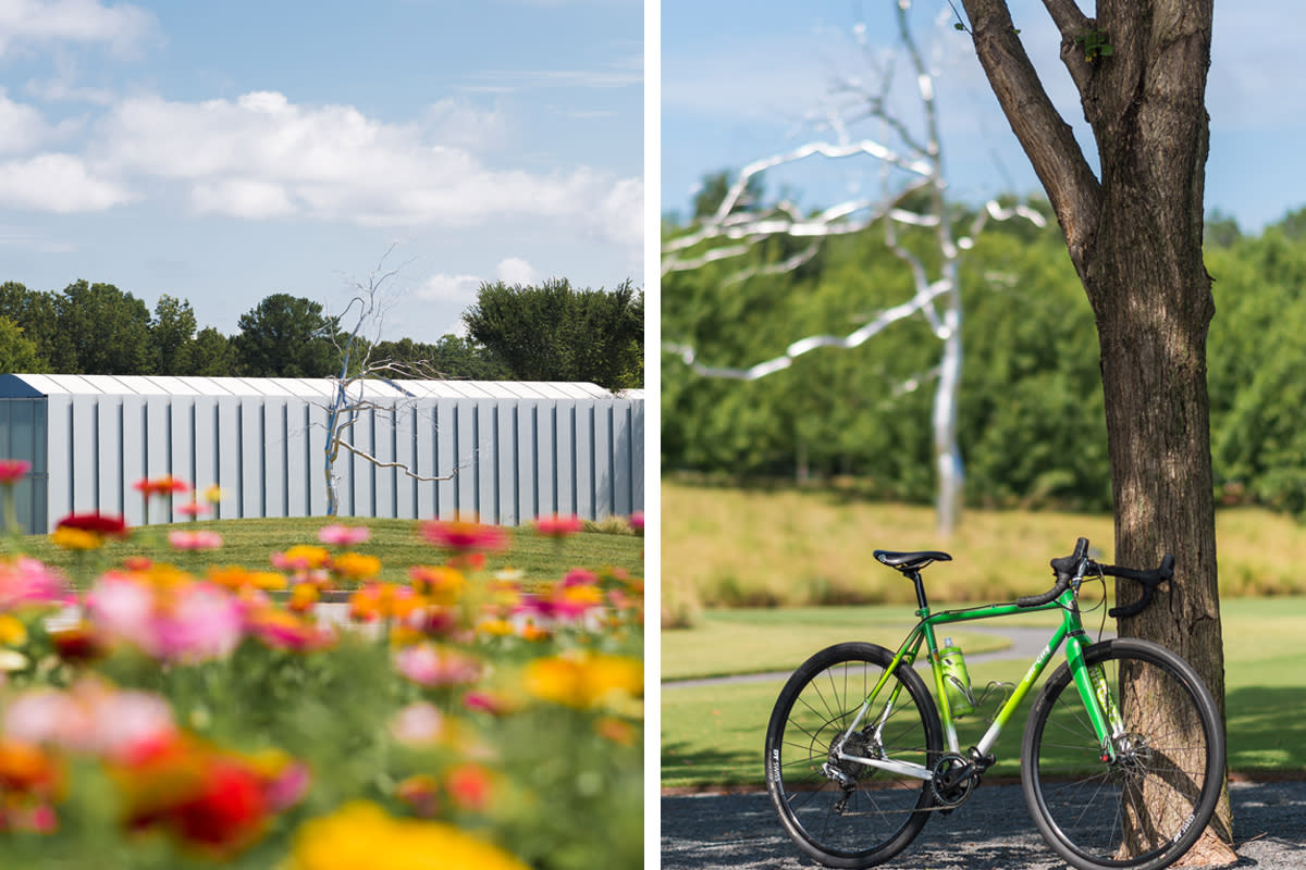
To begin your trek from the City of Oaks to the Bull City you can start anywhere in downtown Raleigh, but Dorothea Dix Park provides free parking, mostly car-free roads within the park and easy access to the first leg of this bike ride. The first five miles of your route follow the Art to Heart Trail (in reverse), zipping by Pullen Park, cutting through the main campus at North Carolina State University and passing behind Meredith College before ultimately tackling a short but steep hill that signals your arrival at the North Carolina Museum of Art (one of the most cherished indoor and outdoor spaces in Raleigh).
See the full route map for this section here.
Pro tip: Fuel up for the day by picking up coffee and pastries from spots like Bittersweet, Boulted Bread and lucettegrace, just a stone's throw from Dix Park. If you return to downtown Raleigh after your ride, Crank Arm Brewing—a bike-themed brewery—awaits in Raleigh's Warehouse District just a few blocks away.
- Starting location: Begin anywhere in downtown Raleigh, but one suggestion is Dorothea Dix Park. Park at the soccer fields off Hunt Dr., or see this map for more visitor parking areas.
- Mileage and elevation gain on this portion of the route: 5.1 miles, 409 feet elevation gain
- Special considerations: A 0.3-mile stretch on Gorman St. in Raleigh is used to connect the Rocky Branch Greenway Trail to the Reedy Creek Greenway Trail. There is now a protected bike lane open for this portion of the ride.
North Carolina Museum of Art through William B. Umstead State Park
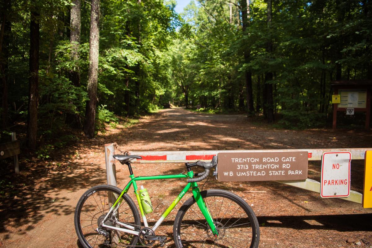
Leaving the North Carolina Museum of Art, you'll head west towards the entrance to William B. Umstead State Park. Using a bike lane, you'll pass the North Carolina Museum of Natural Science's Prairie Ridge Ecostation on your left before crossing Edwards Mill Rd. and then hopping back onto the separated Reedy Creek Greenway. Headed downhill, you'll pass Carl Alwin Schenck Memorial Forest on your left, before climbing uphill to the Trenton Rd. entrance to Umstead State Park (FYI this is a bike and hike entrance only, there is no parking available nearby). From the museum to the Umstead entrance is 2.3 miles.
Umstead is a haven for cyclists who like to be off-road. The 13-miles of multi-use paths within the park are made up of hard-packed dirt surfaces with some spots that have fairly loose gravel. The five-mile route that you'll take from the Trenton Rd. entrance to exit at Old Reedy Creek is hilly, too, making this likely the toughest part of your day (perhaps also the most scenic). You won't need a mountain bike to make it through, but it does help to have wider tires (we recommend tires measuring 32mm and up) as you won't see any pavement on your route through the park.
See the full route map for this section here.
- Starting location: The North Carolina Museum of Art, with plenty of free parking seven days a week
- Mileage and elevation gain: 7.7 miles, 401 feet elevation gain
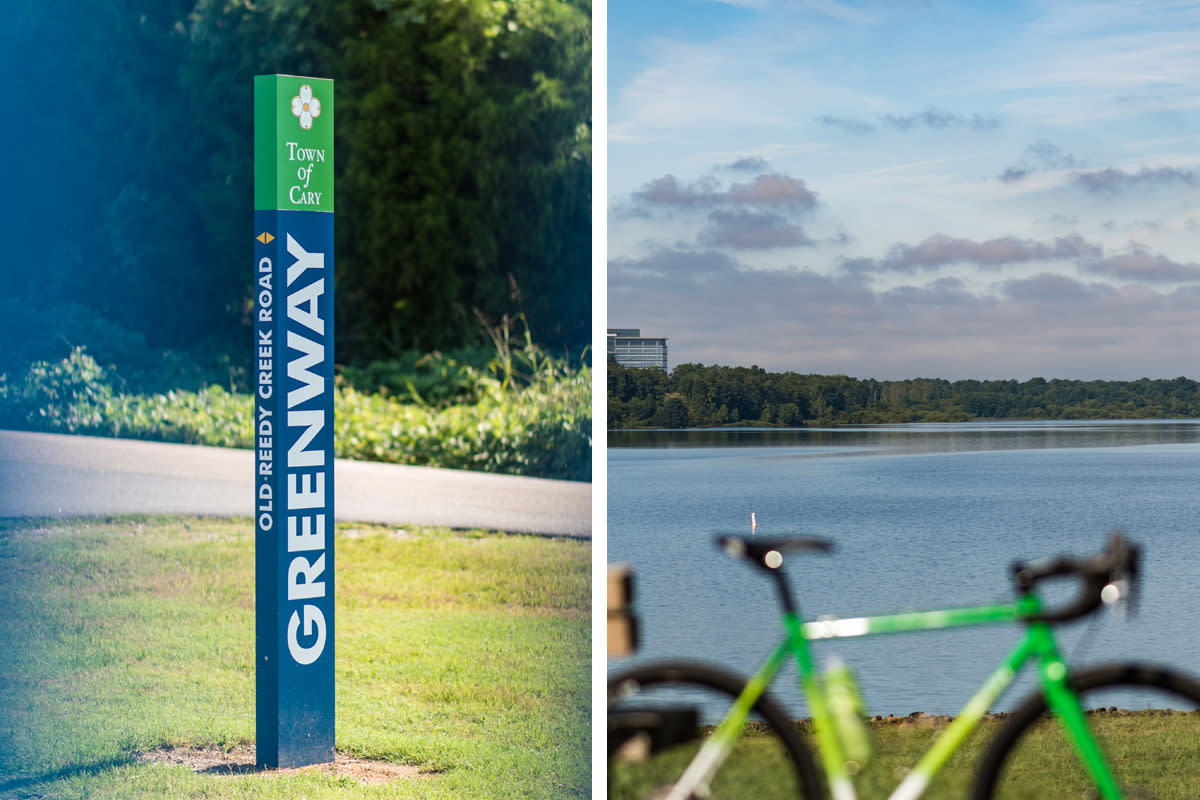
Old Reedy Creek Trailhead to Bond Park
Exiting Umstead State Park, riders cross a bridge over the interstate and quickly find the Old Reedy Creek Trailhead, a new-ish trailhead built by the Town of Cary that gives outdoor enthusiasts access to Umstead, Lake Crabtree County Park and Cary's Black Creek Greenway (the path this route follows).
Mostly flat with a few short and steep hills (the W. Dynasty Dr. hill at mile 15 is either fun or cruel, depending on your outlook), the Black Creek Greenway travels north to south, quietly passing by neighborhoods, schools and shopping areas. A number of food and drink options are visible along portions of this route (including along N.W. Maynard Rd., where a Trek bike shop also sits in case you have a maintenance need), so a stop for more fuel is a good idea if you might need it. Options are more limited after Bond Park.
See the full route map for this section here.
- Starting location: The Old Reedy Creek Trailhead (2139 Old Reedy Creek Rd., Cary) has 82 parking spaces, restrooms, water fountain and a bike fix-it station
- Mileage and elevation gain: 7 miles, 440 feet elevation gain
- Special considerations: Portions of this stretch make use of a sidewalk along N.W. Maynard Rd. for about 0.4 miles
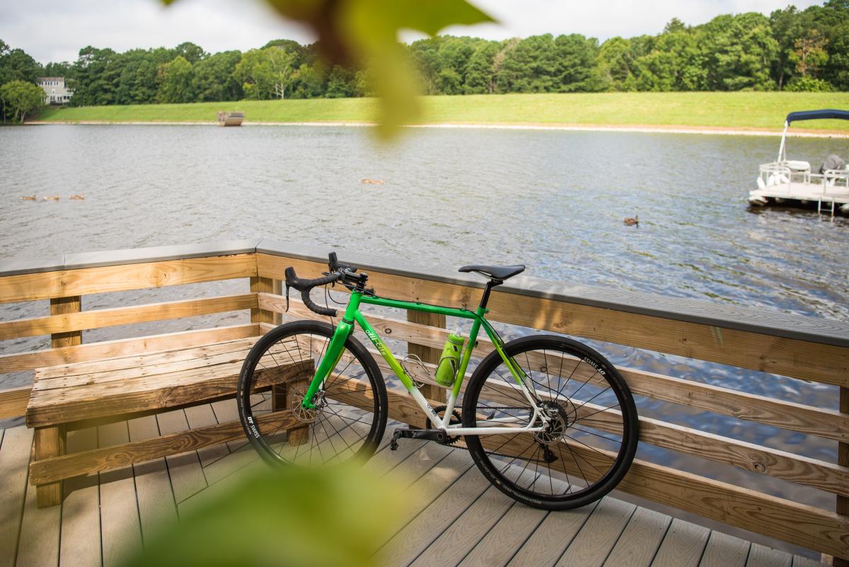
Bond Park to the American Tobacco Trail
Fred G. Bond Metro Park in Cary is wildly popular among families. Picnic tables, boat rentals, rocking chairs and an open field for kite flying are major draws, plus the lake views are pretty, and the park is an appreciated reason to stop for a short break.
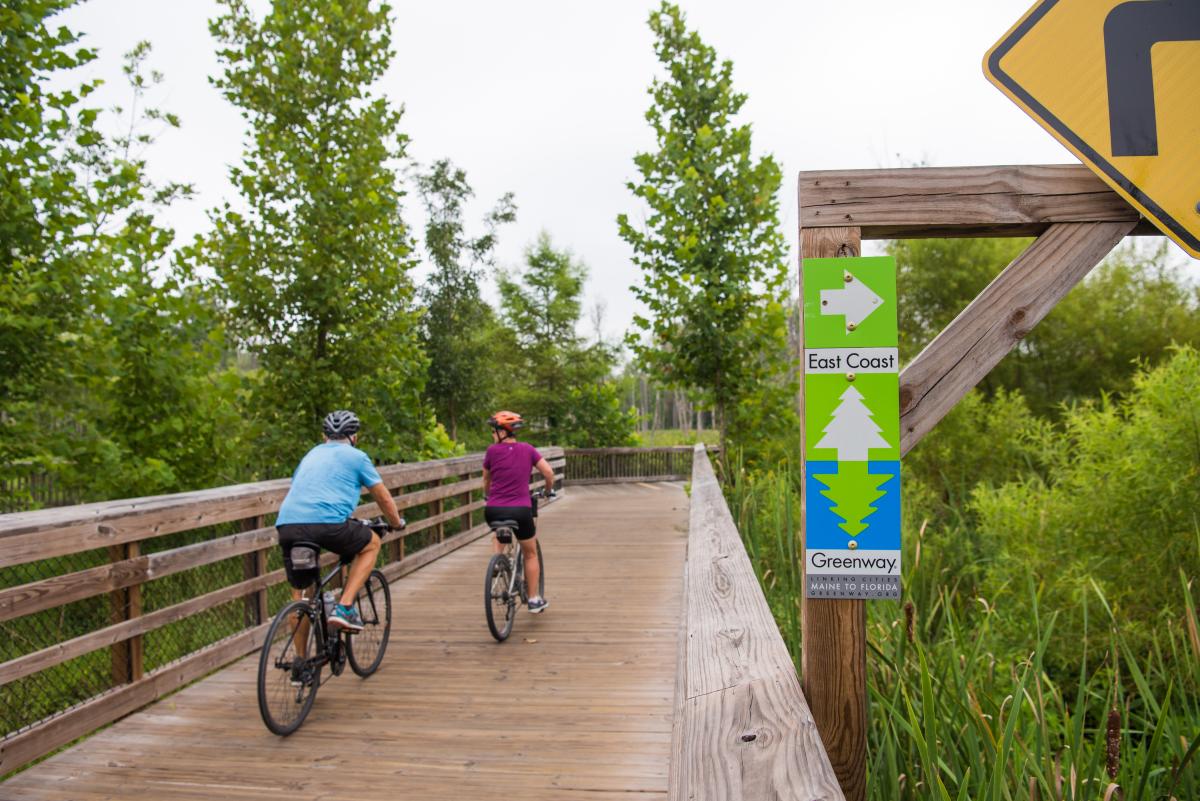
Leaving Bond Park and continuing west, riders are now on the White Oak Creek Greenway, a pivotal trail that in the last 18 months completed construction on two previously unfinished connections that have made finally made this ride possible.
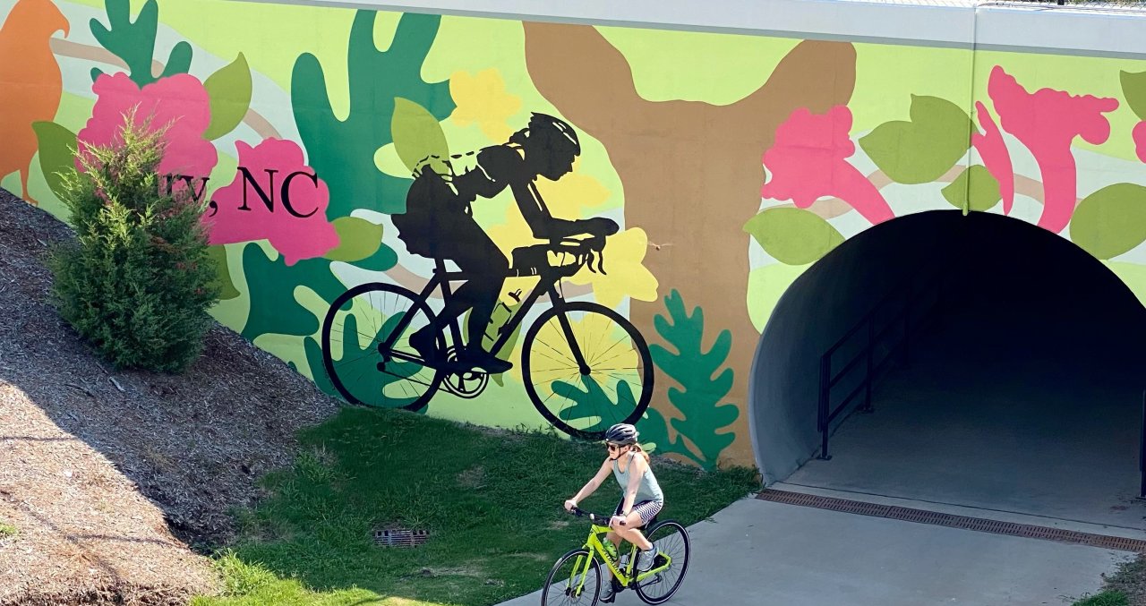
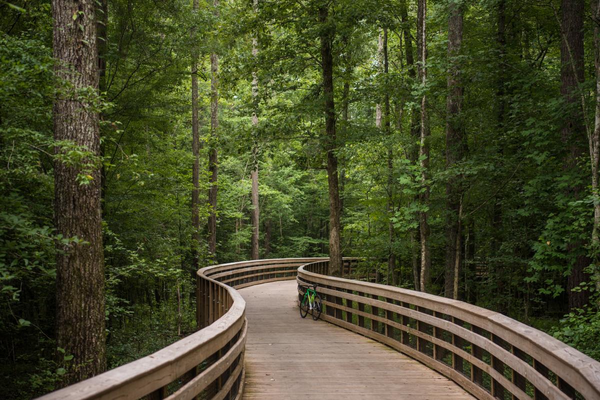
The White Oak Creek Greenway is best recognized for the numerous winding boardwalk sections (seen below) and vast amount of surrounding greenery, including the beautiful wetland area found at mile 25 of this full route (seen above). This seven-mile stretch is among the most scenic in the Raleigh area, and it's mostly flat, so enjoy it!
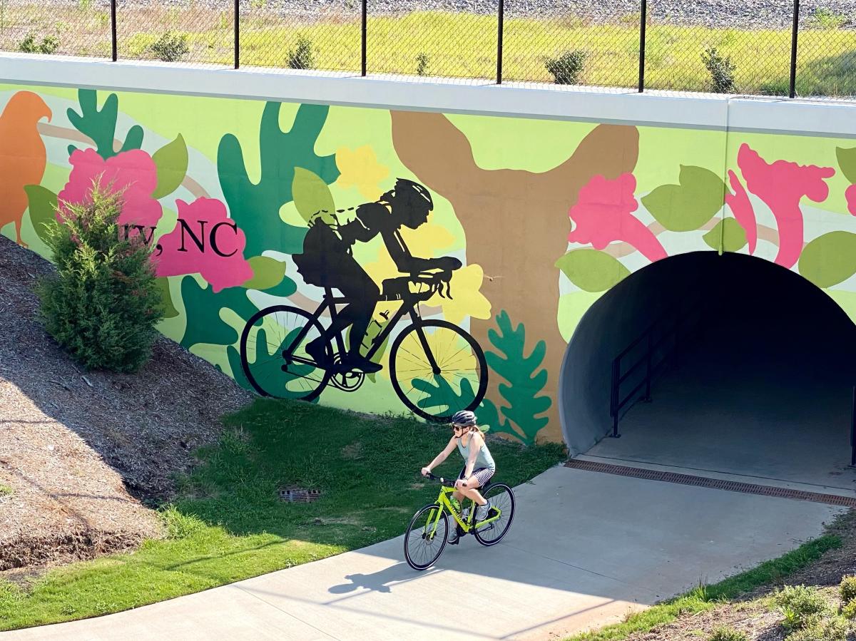
Mural above by Lisa Gaither. See the full map route for this section here.
- Starting location: Fred G. Bond Metro Park, one of Cary's most popular parks for families
- Mileage and elevation gain: 7 miles, 130 feet elevation
American Tobacco Trail to Durham
A right-hand turn off the White Oak Creek Greenway puts you on the American Tobacco Trail (ATT)—a recreational rail-trail located on an abandoned railroad corridor of the Norfolk Southern Railroad—and on the home stretch towards Durham. More than 22 miles of trail in total, the ATT opened in sections, first in downtown Durham in 2001, later in Wake County in 2003. The completion of a bridge over the interstate in Durham in 2014 finally connected the entire trail as one piece.
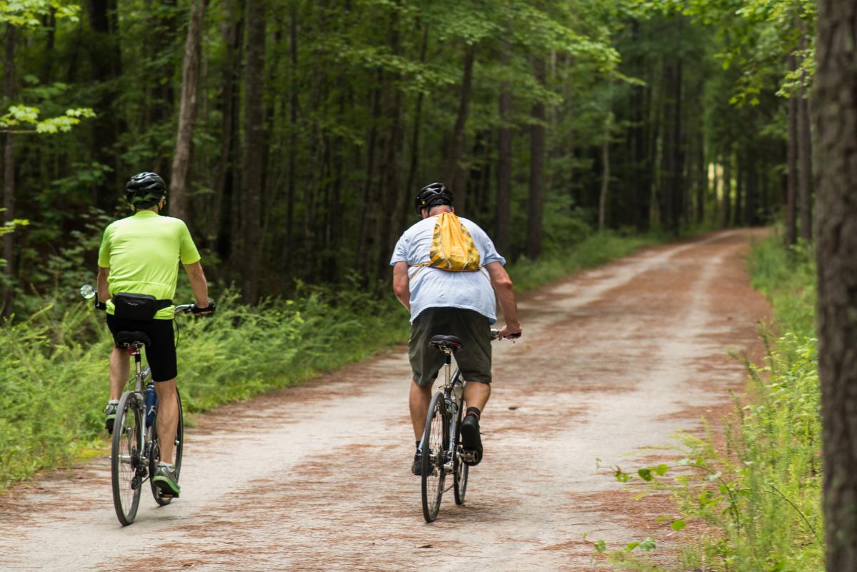
The trail is well-trafficked, mostly flat and made up of hard-packed dirt for the first handful of miles before turning to pavement. As you near Durham, the surrounding scenery will change from woodlands to neighborhoods, and eventually you'll find yourself just outside of Durham Bulls Athletic Park. From here, grab a bite to eat and a beer if you aren't riding back to Raleigh.
For transportation options to get you back to your starting point, see the schedules for GoTriangle buses and Amtrak trains. Bikes can be brought on the Carolinian and Piedmont Amtrak trains for free but must be reserved in advance. Cost typically starts at $7 for a ticket from Durham to Raleigh, the ride taking approximately 35 minutes to drop off at Raleigh Union Station in downtown Raleigh.
Remember to follow proper trail etiquette on the ATT (and all other trails as well). You can find information about sharing the trail with other cyclists, joggers and horseback riders here.
See the full map route for this section here.
- Starting location: The intersection of the White Oak Creek Greenway with the American Tobacco Trail is just a quarter-mile north of the Wimberley Rd. parking area for the ATT
- Mileage and elevation gain: 18.3 miles, 513 feet elevation gain

Note: Authored by David Menconi, this piece has been produced in partnership with Raleigh Arts . Menconi's latest book,... View More
Note: Authored by David Menconi, this piece has been produced in partnership with Raleigh Arts . Menconi's latest book,... View More
Raleigh wears its nickname with pride. The City of Oaks is no stranger to great outdoor spaces—lush, lively and packed... View More
Note: Authored by David Menconi, this piece has been produced in partnership with Raleigh Arts . Menconi's latest book,... View More
Note: Authored by David Menconi, this piece has been produced in partnership with Raleigh Arts . Menconi's latest book,... View More
There's no shortage of ways to find peaceful escapes in order to explore the outdoors in the City of Oaks. Use any of the... View More
The MICHELIN Guide—widely considered the world's foremost guide to exceptional dining—has finally landed in... View More
Note: Authored by David Menconi, this piece has been produced in partnership with Raleigh Arts . Menconi's latest book,... View More
